


Tactile Maps: The Art of Limitless Orientation and Discovery
CITISLAB: Inclusive Communication and Design for All at the Service of Cultural Heritage.
In an ever-changing world, access to knowledge and full enjoyment of urban, cultural and natural spaces can no longer be a privilege, but a universal right. This is the deep conviction that guides CITISLAB’s vision: to build a future in which the communication of cultural, environmental and landscape assets is an experience truly for all, without exception and without limits, applying the principles of “Design for All.”
Our mission is embodied in the creation of inclusive, multisensory and accessible communication solutions and products. We aim to overcome all sensory and cognitive barriers, transforming exploration and learning into an engaging journey of discovery for every user, including people with visual impairments, the visually impaired and blind, the deaf, and individuals with mild cognitive difficulties.
At the heart of this mission, Tactile Maps represent a fundamental and irreplaceable tool. They are not mere aids, but true tools of autonomy, knowledge and inclusion that embody the excellence of our design philosophy.
Tactile Maps: Orientation, Autonomy and Knowledge
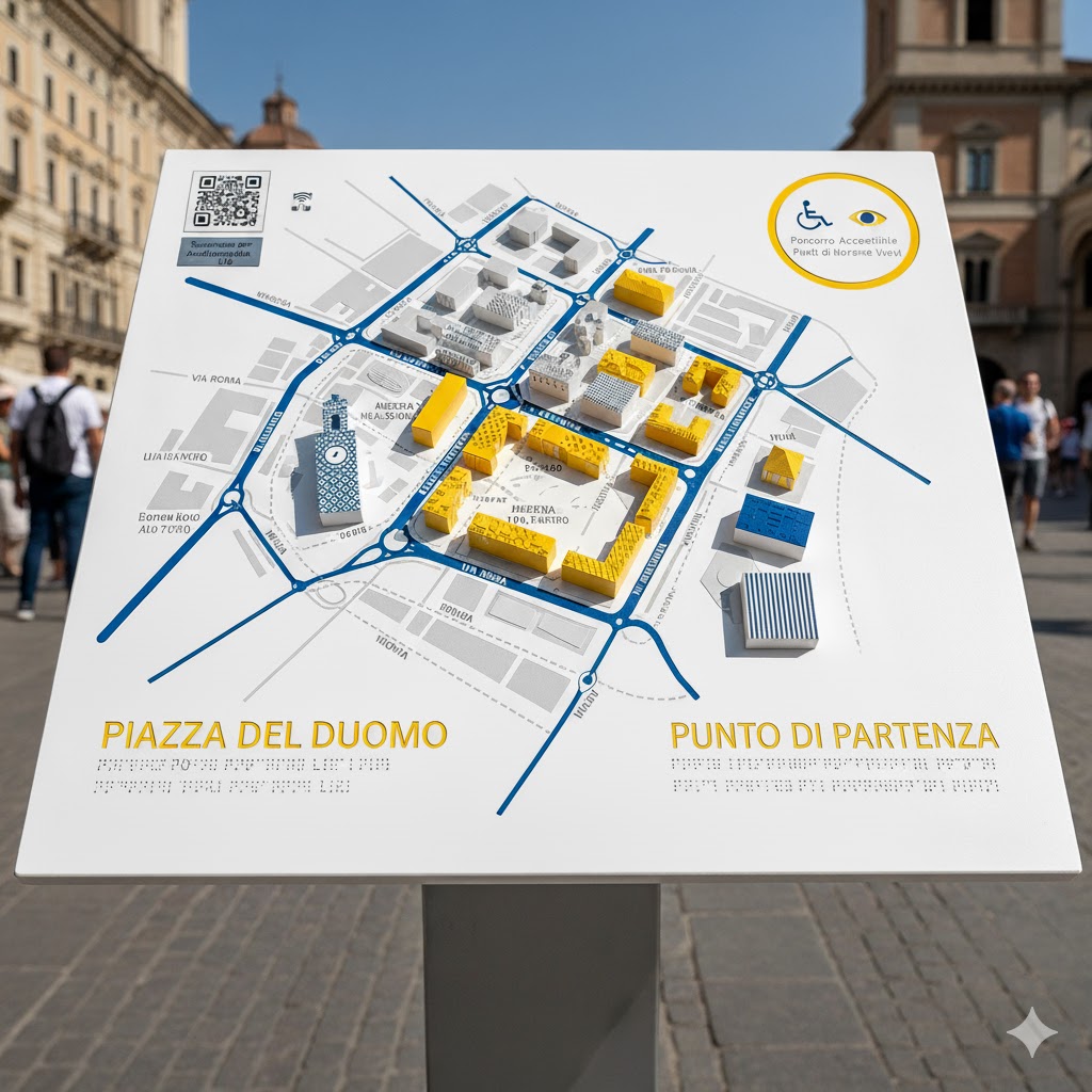
What exactly are tactile maps and why are they so crucial? Tactile maps are raised graphic representations specifically designed to be read through touch, often in synergy with sight through the use of high-contrast colors. They are key to independent orientation and spatial understanding by people with visual impairments, but they actually enrich the experience of anyone who approaches them.
The Pillars of a CITISLAB Tactile Map.
An effective tactile map, such as those designed by CITISLAB, cleverly combines several elements to ensure maximum accessibility:
- Geometric Surveys and Distinctive Textures: Tactile lines, dots, and patterns represent boundaries, structures, paths, and points of interest. Different textures make it possible to distinguish different types of spaces or elements (e.g., a park from a building).
- High Contrast Colors: Essential for the visually impaired, colors are chosen to maximize readability and identification of key elements, facilitating joint enjoyment of touch and sight.
- Braille captions: They accompany surveys, providing critical information such as names of streets, buildings, monuments or directional directions.
- Hybrid Integration (Tactile + Digital): The insertion of QR Codes, NFC Tags or audio-descriptions (often via special media or links) transforms the map into a multi-sensory and interactive tool, crucial for the effectiveness of deaf signage and in-depth content.
Our maps go beyond the mere function of orientation, becoming a vehicle for knowledge and cultural dissemination.

Tactile signage and production methodologies
Tactile Maps: a pathway visible by touch
Applications of CITISLAB Tactile Maps.
The versatility of our products allows us to meet a wide range of needs, transforming any environment into an inclusive space.
- Tactile Signage Maps for Urban Routes
- Tactile Urban Map: A representation of a city or neighborhood plan, essential for orientation in train stations, airports, city centers, and suburban areas. They allow the user to georeference and plan a route independently.
- Modular and Interactive Tactile Signage: Innovative systems that overcome the limitations of fixed installations. Our tactile signs and linear tactile strips (LVE – Loges Vet Evolution) safely guide along pathways, with the ability to access voice or LIS (Italian Sign Language) directions via digital integration.
- Tactile Maps for the Usability of Cultural and Landscape Routes.
- Tactile Maps of Architecture: report details describing the various parts of a historic or monumental building through tactile transposition of floor plans, elevations, and sections.
- Museal Tactile Maps: relief redesigns of works of art, archaeological finds or scientific models. They are an aid that enables independent, in-depth exploration within museum exhibition halls.
- Landscape and Science Tactile Maps: tools for inclusive communication of landscapes, villages, parks, archaeological areas, nature reserves and scientific places, spreading knowledge about ecosystems, scientific processes and biodiversity.
These are not just objects, but complete solutions for an inclusive and profound experience from Custom Design and Quality Materials: We offer customized solutions in size, material (Plexiglas, Polycarbonate, Corian, Aluminum, etc.) and printing technology. Durability and weather resistance are guaranteed, for both indoor and outdoor installations.
Your Next Tactile Map for a More Inclusive World.
If you are a public agency, museum, transportation company or cultural institution and want to transform your spaces into a model of universal accessibility, CITISLAB’s tactile solutions are the answer. Learn how we can design and install an integrated system of tactile maps, tactile signs, and tactile pathways that will make a difference for your audience.